The Best 8 Rift Valley Lakes In Kenya
The Best 8 rift valley lakes in Kenya include Lake Turkana, Lake Magadi, Lake Baringo, Lake Bogoria, Lake Naivasha, Lake Nakuru, Lake Logipi, and Lake Elmenteita
Kenya’s Great Rift Valley, which stretches from north to south throughout the nation, is an important geological feature. The Arabian, Nubian, and Somalian tectonic plates interacted to build it, and it is a component of the broader East African Rift system. The valley is distinguished by its varied topography, which includes a number of escarpments, volcanoes, and lakes, which include Baringo, Bogoria, Nakuru, Elmenteita, Naivasha, Magadi, Logipi, and Turkana. This blog will take you on a tour to the Rift Valley Lakes, examining their formation, distinctive characteristics, and amazing natural events that make this area so special.
The best 8 Rift Valley Lakes in Kenya include the following;
1. Lake Turkana
Saline Lake Turkana, historically called Lake Rudolf, is situated in the Kenyan Rift Valley and stretches into Ethiopia and northern Kenya. It is the largest permanent desert lake in the world, as well as the largest alkaline lake in the world. With respect to volume, the lake is the fourth-largest saltwater body in the world, behind Lake Van, Issyk-Kul, and the Caspian Sea. Lake Turkana ranks just 24th in terms of total size among all lakes, despite its size.
The lake has some qualities that set it apart, like excessive salinity and fluoride levels, which make it unsafe to drink due to health dangers from contamination. As a result, local people are increasingly relying on underground springs as a source of drinking water. The region’s arid climate further reduces the lake’s usefulness for irrigation.
Physical characteristics of lake Turkana:
- Location: North-West Kenya and South-West Ethiopia
- Lake type: alkaline, saline, monomictic, endorheic
- Primary Inflows: Omo River is the primary perennial tributary to Lake Turkana, contributing over 90% of its inflow; other seasonal inflows include Turkwel River and Kerio River
- Basin Countries: Ethiopia, Kenya, and South Sudan
- Basin: Lake Turkana lies in a low, closed basin at approximately 365 meters above sea level
- Maximum length: 260 kilometers
- Maximum width: 30 kilometers
- Surface area: Approximately 7,560 square kilometers
- Water volume: 237 cubic kilometers
Threats and environmental concerns:
Human activity poses serious risks to Lake Turkana, especially with the development of the Gilgel Gibe III Dam in Ethiopia. The Omo River damming directly jeopardizes Lake Turkana’s biological balance and water levels because it contributes to a significant amount of the lake’s water. Environmentalists and scientists are concerned about the possible effects of changed water flow patterns on the ecosystem of the lake.
Furthermore, Lake Turkana is facing further environmental difficulties as a result of overfishing and dropping water levels. Water sources are running out and irresponsible fishing methods are putting the lake’s vast biodiversity of fish species at a risk.
Cultural significance and UNESCO recognition:
There are many different indigenous tribes living near Lake Turkana, including the Turkana, Rendille, Daasanach, El Molo, and others. As a result, the area around the lake is extremely important culturally. These communities are historically connected to the region and depend on its resources for their daily needs.
In recognition of the region’s natural significance and cultural legacy, Lake Turkana National Park has been inducted as a UNESCO World Heritage Site. Renowned for their distinct habitats and populations of Nile crocodiles, Central Island National Park and South Island National Park are also located inside Lake Turkana
Understanding paleoenvironment:
The old paleoenvironments that once existed in the area millions of years ago can be better understood by looking at the geological history of Lake Turkana. In order to learn more about historical ecosystems and how creatures evolved to adapt to shifting environmental conditions throughout time, scientists examine the stratigraphy of the Turkana basin
Every stage of Lake Turkana’s geological evolution provides an insight into the variety of habitats that formerly flourished in this dynamic environment, from ancient flood plains to prehistoric lakes like Lonyumun Lake and Lokochot Lake. Fossil finds provide light on species interactions and evolutionary processes in this historically rich region, including the remains of hominids like Kenyanthropus platyops
2. Lake Magadi
Situated in the Great Rift Valley of southern Kenya, Lake Magadi is an alkaline, saline lake. Being a prominent natural landmark in the area, it is renowned for its distinct features and geological formations. With fractured volcanic rocks encircling it, the lake’s environs which span an area of about 100 square kilometers, are uniquely picturesque
Lake Magadi’s geological features are quite amazing. The lake’s extreme salinity is a result of its location in an endorheic basin created by a graben. Large amounts of trona, a mineral containing sodium sesquicarbonate, precipitate out of the lake’s dense brine of sodium carbonate. The salt deposits in some places can reach a thickness of 40 meters.
Physical characteristics of Lake Magadi:
- Size and location: Lake Magadi is one of the smaller lakes in the area, covering about 100 square kilometers. It is located in a watershed of fractured volcanic rocks, north of Tanzania’s Lake Natron, in the southernmost region of the Kenyan Rift Valley
- Composition: The lake is well-known for being extremely alkaline and salinized. During the dry season, soda covers it, covering up to 80% of its surface in soda deposits. Thick layers of sodium sesquicarbonate or trona, are produced by the dense sodium carbonate brine in the lake; in certain places, these deposits can be as thick as 40 meters
- Water source: The main source of recharging for Lake Magadi is its saltwater springs, which may reach temperatures of 86°C. Because the area is arid, there is minimal surface runoff, so these hot springs discharge into alkaline “lagoons” at the lake edges
- Siliceous Chert Deposits: Many siliceous chert deposits, including the well-known “Magadi-type chert,” may be found in Lake Magadi. These cherts were discovered both as bedded cherts within the lake and as intrusive dike-like formations that breached the underlying sediments. They developed from the sodium silicate mineral precursor magadiite
- Human activity: Since 2005, Tata India has acquired a soda factory located in the village of Magadi on the lake’s eastern shore. Utilizing the rich sodium carbonate reserves of Lake Magadi, the facility creates soda ash.
Hydrology and Hot Springs:
Lake Magadi has no outflow, and evaporation is the main way that water disappears from the lake. Saline hot springs that can reach 86°C are the primary source for recharging the lake. Alkaline “lagoons” around the lake edges receive the discharge of these hot springs. The northwest and southern lakeshores are home to the majority of the hot springs.
Flora and Fauna:
Lake Magadi is home to various unusual living species, despite its harsh environment. The cichlid Alcolapia grahami is one famous species that can be found in the lake. It has adapted to live in the hot, extremely alkaline waters of the basin. The lake is a famous place for birdwatching because of its rich algae content, which attracts wading species, especially flamingos.
Tourism and Recreation:
Lake Magadi has developed into a popular tourist destination, with lodging choices for those eager to experience its distinct surroundings. A causeway gives access to the Nguruman Escarpment and other regions west of the lake. Travelers take pleasure in birdwatching expeditions and take in the breathtaking scenery that surrounds the saltwater pan.
3. Lake Naivasha
Just outside the town of Naivasha, in Nakuru County, lies a freshwater lake called Lake Naivasha. In the Great Rift Valley, it is located at an elevation of 1,884 meters. The term “Naivasha,” which means “that which heaves” in the Maasai language, is the source of the name “Lake Naivasha.” It describes water bodies that are large enough to cause waves in windy or stormy weather.
With sedimentary deposits from the Pleistocene Era and volcanic rocks, the lake’s geological makeup is complicated. It receives water from the Malewa and Gilgil rivers. Although it doesn’t have a visible outlet, its very fresh water makes it likely that it has one below ground. Lake Naivasha’s surface area grew throughout time, reaching 198 square kilometers by 2020.
Physical characteristics of Lake Naivasha:
- Location and Geological Features: At a height of 1,884 meters (6,181 feet), Lake Naivasha is located in the Great Rift Valley. There are sedimentary layers from the Pleistocene Era and volcanic rocks all around it. Given its relatively fresh water content, it is believed that the lake, which is supplied by the perennial Malewa and Gilgil rivers, has an underground outflow even if there is not a visible exit.
- Size and Depth: Before 2010, Lake Naivasha covered 139 square kilometers, or 54 square miles, but by 2020, it has grown to 198 square kilometers, or 76 square miles. At Crescent Island, the lake’s lowest point is 30 meters (98 feet) below the surface, with an average depth of about 6 meters (20 feet) throughout.
Ecology of Lake Naivasha:
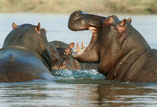
Numerous animal species, including more than 400 bird species and a sizable population of hippos, can be found on Lake Naivasha. The arrival of invasive species like common carp in 2001, fishing activity, and climate change have all had an impact on the lake’s fish ecosystem. In 2010, the majority of the lake’s fish population consisted of common carp.
In addition to its abundant flora and fauna, Lake Naivasha is home to two other smaller lakes, Lake Oloiden and Lake Sonachi.
History and Human Impact:
In the past, Lake Naivasha was used as a flying boat landing site for flights operated by Imperial Airways between Britain and South Africa. Over time, the ecosystem of the lake has been greatly altered by human activities, including industry and agriculture. A significant industry near the lake is floriculture, which raises questions about how irrigation water use may impact the lake’s water levels.
The environmentally balanced nature of the lake has been threatened by the development of the agricultural sectors along its shorelines. In addition, variations in water levels have been seen over time as a result of a variety of variables, including human activity and patterns of rainfall.
Activities and Attractions:
Visitors can enjoy a variety of activities in Lake Naivasha, such as boat safaris where they can get up close and personal with flamingos and hippos. Popular destinations like Crescent Island and Crater Lake Game Sanctuary are well-known for seeing animals. Nearby Longonot National Park offers trekking options with breathtaking views of Mount Longonot.
4. Lake Nakuru
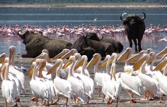
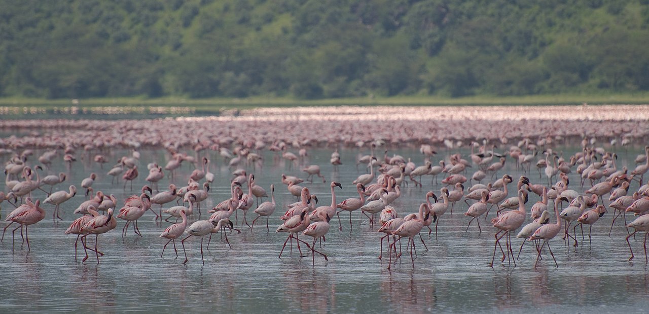
Known for its varied wildlife species and breathtaking surroundings, Lake Nakuru National Park is a well-liked safari destination in Central Kenya’s Nakuru County. Home to the well-known Lake Nakuru, a soda lake in the Rift Valley, the park is located three to four hours northwest of Nairobi. The most recognizable aspect of the park is the large number of pink flamingos that congregate around the lake because blue-green algae abounds there, which serves as their main food source.
Physical characteristics of Lake Nakuru:
- Location and Elevation: Lake Nakuru is about 164 kilometers (102 miles) north of Nairobi, in the southern part of the Kenyan town of Nakuru. 1,754 meters (5,755 ft.) above sea level is the elevation at which it is situated.
- Water Composition and Alkalinity: The alkaline nature of Lake Nakuru adds to its distinct environment and draws a wide range of wildlife and bird species to its borders. Because of the warm, alkaline waters, algae may bloom and provide food for aquatic animals like flamingos.
Flora and Fauna: With more than 400 different bird species living there, Lake Nakuru National Park has a remarkable biodiversity. A variety of bird species, including African Fish Eagle, Pink-backed Pelican, and Grey-crested Helmetshrike, can be found in the park in addition to flamingos. A wide variety of species, including zebras, buffaloes, hippos, rhinos, and more, can be seen in the park. Notably, Lake Nakuru is home to more than 100 endangered rhinos and functions as a rhino sanctuary.
Unique Features and Conservation Efforts:
To safeguard the park’s fauna and deter poaching, an electric fence has been installed. It has elevated peaks that provide expansive views for wildlife and birds. Lake Nakuru National Park has a sub-humid climate, which makes it a popular tourist destination all year round. Easy access to various regions for the best wildlife viewing experiences is ensured by the park’s well-established road network.
Challenges and Environmental Concerns:
Lake Nakuru has experienced contamination from the dumping of industrial waste and varying water levels over the years, among other environmental concerns. These elements have affected the flamingo population and caused migrations to Lake Bogoria and other neighboring lakes. Variations in water levels and ecosystem conditions in the area have also been influenced by human activity and climate change.
5. Lake Baringo
North of Lake Turkana in the Kenyan Rift Valley sits a freshwater lake called Lake Baringo. It is located at an elevation of 970 meters and occupies an area of 130 square kilometers. Numerous rivers, notably the Ol Arabel, Perkerra, and Molo feed the lake, which lacks a clear outflow. Being home to more than 470 different species of birds and acting as a vital habitat for a variety of wildlife, it is renowned for its unique environment.
Physical Characteristics of Lake Baringo:
- Location and geography: Located in the Great Rift Valley of west-central Kenya, Lake Baringo is 3,200 feet (975 meters) above sea level. After Lake Turkana, it is the most northern lake in the Kenyan Rift Valley, located east of the Kumasi (Ilkamasya) Hills. The lake is 11 miles (18 km) long and 5 miles (8 km) wide, with an area of 50 square miles (129 square km). Lake Baringo is 17 feet (5 meters) deep on average. At its northern edge, the freshwater lake seeps into lava formations and lacks a discernible exit.
- Hydrology and Ecology: The Molo, Perkerra, and Ol Arabel rivers are some of the rivers that feed Lake Baringo. The water is thought to infiltrate through lake sediments into the fractured volcanic bedrock, even though there is no clear exit. Numerous bird species can be found living around the lake’s shoreline, contributing to its rich ecosystem. In the lake, crocodiles and hippos can also be found. Numerous animal species, including fish like tilapia and lungfish, call the area surrounding Lake Baringo home.
- Islands and Surrounding Areas: The largest of the tiny islands in Lake Baringo is Ol Kokwe Island. Sulfur deposits have formed on this island, an extinct volcanic center with fumaroles and hot springs. To the west of the lake are the Tugen Hills, and to the east is the Laikipia Escarpment. Important paleontological and archaeological sites that have produced fossilized hominoids and hominins.
Tourism and Local Communities:
Smaller communities like Kampi ya Samaki and Loruk are close to Marigat, the principal town around Lake Baringo. There are now more hotels, self-catering cottages, and camping sites in the area due to the growth in tourism. Fishing is the main source of food and economic activity for the local towns that surround the lake.
6. Lake Logipi
In Kenya’s northern region, close to the Ethiopian border, sits Lake Logipi, an alkaline and salty lake. The highest depth is around 5 meters, and it spans an area of roughly 30 square kilometers. With a pH of between 9.5 and 10.5, the lake’s water is extremely alkaline and rich in salt and other minerals. Various fish and bird species eat the unusual ecology of algae, diatoms, and other microorganisms that Lake Logipi supports, despite its severe environment.
Because of the lake’s severe alkalinity, a wide variety of plants and animals have developed to withstand the harsh circumstances and thrive in its habitat. The alkaline tilapia, which can withstand high saline levels, and the Logipi crab, which is unique to this region are two note-worthy species. In order to thrive in the dry climate and alkaline soil, the surrounding vegetation has likewise evolved.
Physical characteristics of Lake Logipi:
- Size and dimensions: Lake Logipi measures roughly 6 km in width and 3 km in length, with a maximum depth of 3 to 5 meters.
- Water Composition: Lake Logipi’s waters have a pH range of 9.5 to 10.5 and are primarily composed of sodium bicarbonate.
- Salinity Levels: The salinity (total dissolved salts) of Lake Logipi varies from less than 20 g/L to greater than 50 g/L.
- Geological Features: Efflorescent salt crusts, known as trona, are present around the margins of the lake.
- Hot Springs: Saline hot springs discharge on the northern shoreline of Lake Logipi and at Cathedral Rocks near its southern limit, contributing to maintaining water levels during periods of extreme aridity.
- Recharge Sources: The Suguta River, which flows northward along the Suguta Valley during the rainy season, replenishes the lake. Occasionally, it forms a temporary lake called Lake Alablab, which eventually joins with Lake Logipi.
Bird Watching at Lake Logipi:
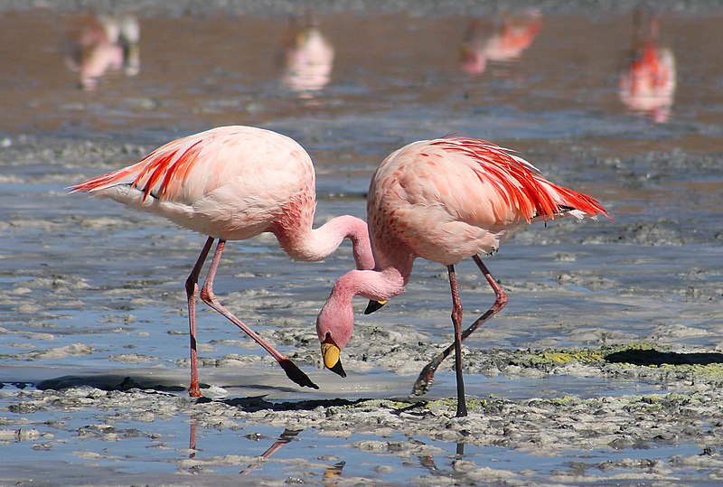
Because of its varied bird population, Lake Logipi is a well-liked spot for birdwatchers. Around the lake, visitors can see storks, pelicans, herons, and flamingos, among other waders. The lesser flamingo, which gets its name from its pink feathers, is a frequent visitor to Lake Logipi, where it feeds on the algae that grows well in the alkaline waters. At Lake Logipi, early mornings are the best times to go birdwatching because this is when the birds are most active.
Hot Springs at Lake Logipi:
The hot springs that flank Lake Logipi’s eastern coast are one of its most remarkable features. Geothermal activity beneath the lake’s surface heats mineral-rich water, which rises to generate hot spring pools. By taking a bath in these hot springs, visitors can experience the healing benefits associated with them.
Because of their mineral richness, the hot springs are thought to have therapeutic effects for ailments like rheumatism, arthritis, and skin problems. It is recommended to exercise caution when visiting these hot springs due to the unusually high water temperature, which can result into burns.
Cultural Experiences at Lake Logipi:
Pastoralist communities that have been living according to their traditional ways for generations occupy the area around Lake Logipi. It is possible for visitors to interact with these communities and gain knowledge of their distinctive rituals, traditional dress, cuisine, and way of life. The rich history of these indigenous people living close to Lake Logipi is revealed through this cultural exchange.
A comprehensive picture of life around Lake Logipi can be gained by investigating the cultural components of the area, which enriches tourists’ experiences beyond those of natural features.
7. Lake Bogoria
Kenya’s Baringo County is home to Lake Bogoria, originally known as Lake Hannington, an alkaline, salty lake. Situated slightly north of the equator, it is situated in a half-graben basin south of Lake Baringo, within a volcanic zone. The lake has a shallow depth of roughly 10 meters and measures about 34 km in length and 3.5 km in width. Like other lakes in the Rift Valley, Lake Bogoria is well known for having one of the greatest populations of lesser flamingos in the world
As a protected National Reserve since November 29, 1973, the lake is part of the Ramsar site. Along its banks and within the lake itself, it exhibits distinctive geological phenomena, including hot springs and geysers. Near the lake, there are a minimum of ten geysers with a maximum height of five meters that erupt. Changes in the lake level have an impact on the activity of the geysers.
Physical Characteristics of Lake Bogoria
- Size and depth: The maximum depth of Lake Bogoria is approximately 10 meters, and its dimensions are roughly 34 km long and 3.5 km wide.
- Location and surroundings: Located slightly north of the equator in a half-graben basin, south of Lake Baringo, Kenya, in an area characterized by volcanic activity. The Siracho Escarpment borders it to the east, and the Kesubo Swamp to the north.
- Geothermal features: The lake is well-known for the hot springs and geysers that are found both inside the lake and along its borders. Around the lake, there are four different spots where at least ten geysers shoot up to five meters into the air.
Historical significance: Lake Bogoria, which was formerly named after Bishop James Hannington, was significant historically. He visited in 1885. Furthermore, the Endorois people, who were uprooted in the 1970s and are presently contesting their expulsion at the African Commission on Human and Peoples’ Rights, were originally the inhabitants of the area.
Flora:
Land Plants: Due to their adaptation to the hot and dry climate, a variety of terrestrial plants can be found in the area around Lake Baringo. There are doum palms, acacia trees, and other drought-tolerant plants in the area.
Aquatic Plants: Several varieties of aquatic plants can be found in the lake itself, serving as a food source and habitat for a range of aquatic creatures. Because they oxygenate the water and give fish a place to hide, these plants are of high importance.
Fauna:
Birds: There have been over 470 kinds of birds identified at Lake Baringo, making it a popular destination for birdwatchers. For many migratory and resident bird species, the lake provides an essential habitat. A few note-worthy avian species are flamingos, fish eagles, kingfishers, and Goliath herons.
Fish: Several kinds of freshwater fish, including the endemic Oreochromis niloticus baringoensis Nile tilapia subspecies, may be found in the lake. As a result of the marbled lungfish’s introduction, the lake’s fish supplies have increased significantly, even while Nile tilapia populations have decreased.
Mammals: A variety of animal species, including greater kudus (found on the sides of the Laikipia Escarpment), hippos, and other mammals adapted to the semi-arid climate can be found in the area surrounding Lake Baringo
Reptiles: In addition to crocodiles, the area around Lake Baringo is home to lizards and snakes.
Invertebrates: A variety of invertebrate groups that are vital to the cycling of nutrients and the operation of ecosystems can be found in the lake.
Chemistry and Ecology:
The waters of Lake Bogoria are highly concentrated in Na+, HCO3-, and CO32-ions, which are thought to be a result of inflows from nearby rivers and alkaline hot springs. There are also a lot of real geysers in the lake; at least 18 of them are reported to exist in the area. In Lake Bogoria, the total dissolved salt content can reach up to 100 g/L, making the water saline with a pH of approximately 10.5 and alkaline. The lake’s hypersaline environment is home to a large population of cyanobacteria (Arthrospira fusiformis), which flamingos feed on.
8. Lake Elmenteita
Lake Elmenteita is named after the Maasai term “muteita,” which means “dust place.” It is situated in the Great Rift Valley, approximately 120 kilometers northwest of Nairobi, Kenya. Particularly from January to March, the region is well-known for being dry and dusty. The lake provides a magnificent vista along the main Nairobi-Nakuru highway. It is located in the Rift Valley series, between Lake Naivasha and Lake Nakuru.
The “Kekopey” hot springs at Lake Elmenteita’s southernmost point are home to Lake Magadi tilapia breeding grounds. The abundant bird life around the lake draws night herons and pelicans to the surrounding reed beds.
Physical characteristics of Lake Elmenteita:
- Size and depth: The lake has a maximum depth of 1.9 meters and a surface area of roughly 1,800 hectares
- Water source: The Meroronyi and Kariandusi, two minor streams that originate on the eastern plateau, as well as the Kekopey hot springs at its southernmost point, provide water to Lake Elmenteita.
- Surrounding landscape: dramatic rocky fissures, volcanic outcrops, and cones are features of the lake’s surroundings. The area receives less than 600 mm of rain on average annually.
- Vegetation: Acacia and Tarconanthus camphoratus bushland are the predominant vegetation types surrounding the lake, with Themeda triandra grassland sprinkling in between. There are pockets of Acacia xanthophloea woodland close to the coast.
- Grazing animals on the banks of Lake Elmenteita include warthogs, zebras, gazelles, and elands. The shallow depth and seasonal fluctuations in water levels of the lake have an impact on its ecology.

- Human activities: For irrigation, animal watering, and freshwater supplies, the nearby population depends on the hot springs. The economy of the region also heavily depends on tourism.
- Conservation status: Because of Lake Elmenteita’s significance for regional efforts to conserve biodiversity and birdlife, it has been named a Ramsar site.
The Best Time To Visit The Great Rift Valley Lakes In Kenya
Dry Season (June to October)
Because of the dry, bright weather, this is usually thought to be the ideal time of year to explore the Great Rift Valley lakes. This is a great time to see wildlife since the animals congregate near water sources, which makes it simpler to see them. The nice weather makes outdoor pursuits like hiking, boating, and nature hikes appealing.
Additionally, birdwatching is wonderful, particularly in the vicinity of lakes such as Nakuru, Naivasha, and Elmenteita, where a variety of bird species congregate.
- January through February, the short dry season
There is a brief dry season during this time, which makes it an excellent opportunity to visit the lakes of the Great Rift Valley. There are still plenty of possibilities to see wildlife and observe birds during this time. Swimming, fishing, and boating are all excellent throughout this season.
Wet Season: November through December and March through May
In Kenya, the rainy season comes with more rain, particularly in April and May.
During the rainy season, the scenery is verdant and beautiful, but it can be more difficult to see wildlife because the animals tend to spread out over wider distances. Because migrating bird species come in the area during the wet season, birdwatching is still very good.
Flooding may make certain roads unusable and restrict outdoor activities.
How To Access The Best 8 Rift Valley Lakes In Kenya
Lake Nakuru: Easily reachable from Nairobi. This well-liked location is noted for its enormous flamingo flocks as well as other bird species. Walking safaris and wildlife drives are available at Lake Nakuru National Park, where the lake is situated. By car, it takes three to four hours to get from Nairobi to Lake Nakuru.
Lake Naivasha: Known for its freshwater and varied birds, Lake Naivasha is another conveniently located lake near Nairobi. Along with being an excellent place to visit neighboring sites like Hell’s Gate National Park, it is also great for boat trips and nature walks. From Nairobi, it takes about 1.5 to 2 hours by car to go to the lake.
Lake Bogoria: A unique location in the Rift Valley, Lake Bogoria is well-known for its hot springs and geysers. Although it is a little more isolated than other lakes, it is still reachable by car. It is roughly a five- to six-hour journey from Nairobi to the lake.
One of Kenya’s two freshwater lakes in the Rift Valley is Lake Baringo. In addition to its scenic splendor, Lake Baringo is well-known for its birdlife, which includes flamingos and fish eagles. By car, it takes roughly five to six hours to get to Lake Baringo from Nairobi.
Lake Turkana: The world’s largest desert lake, Lake Turkana is a little further from Nairobi but offers amazing scenery and cultural activities. It often takes longer to get to Lake Turkana from Nairobi, and one can get there either by flight or by car.
Lake Magadi: Known for its soda ash and breathtaking beauty, Lake Magadi is situated in the southern Rift Valley. From Nairobi, it is a fairly straightforward drive that takes three to four hours.
Known for its wildlife and scenic beauty, Lake Elmenteita is a UNESCO World Heritage Site sandwiched between Lake Nakuru and Lake Naivasha. From Nairobi, it is conveniently reachable by road in two to three hours.
Accommodation At The Best 8 Rift Valley Lakes In Kenya
This can be in the form of luxury, mid-range, or budget accommodation facilities. Luxury accommodation targets clients who are able to spend extravagantly on themselves, mid-range accommodation targets clients whose main concern is comfort; and budget accommodation targets clients who are on a very strict budget.
Luxury Accommodation Facilities
- Sarova Lion Hill Game Lodge: Situated in the heart of Lake Nakuru National Park, this lodge provides opulent lodging with expansive views across the lake and surrounding area. It offers upscale cuisine, a swimming pool, guided safari activities, and luxurious accommodations.
- Eliye Springs Resort: This resort, which is located on the banks of Lake Turkana, features safari tents and opulent bungalows with breathtaking lake views. Visitors can visit the nearby Turkana culture and archaeological sites, unwind on the beach, or engage in water sports.
- Island Camp Baringo: Situated on a secluded island in Lake Baringo, this premium resort is only reachable by boat and offers opulent tented accommodations. Gourmet cuisine, 24/7 room service, and recreational opportunities like fishing, boat excursions, and birdwatching are all available to visitors.
Mid-Range Accommodation Facilities
- Flamingo Hill Tented Camp: This tented lodge, which is part of Lake Nakuru National Park, provides cozy lodging with private toilets and balconies that over-look the park. It offers a reasonably priced real safari experience.
- Lake Naivasha Country Club: With rooms and cottages surrounded by lovely gardens, this accommodation facility offers mid-range lodging on the shores of Lake Naivasha. Activities available to guests include boat cruises, nature hikes, and excursions to neighboring sites like Hell’s Gate National Park.
- Oasis Lodge: This lodge, which is close to Lake Turkana in the town of Lodwar, provides comfortable lodging with standard services. It provides a handy starting point for discovering Lake Turkana and its surroundings.
Budget Accommodation Facilities
- Oasis Eco Camp: This inexpensive camp is located close to Lake Elmenteita and provides basic accommodation and camping facilities at reasonable prices. It is an affordable choice for tourists taking in the area’s natural beauty and fauna.
- Lake Bogoria Hotel: This low-cost hotel provides modest amenities and reasonably priced lodging close to Lake Bogoria. For tourists on a tight budget who want to see the local geysers and hot springs, this is a great choice.
Frequently Asked Questions
1. Which Kenyan lakes are part of the Great Rift Valley?
The Kenyan lakes part of the rift valley include, Lake Baringo, Lake Bogoria, Lake Elmenteita, Lake Logipi, Lake Magadi, Lake Naivasha, Lake Nakuru, and Lake Turkana are among the lakes that make up Kenya’s Great African Rift Valley.
2. Which is the largest lake among the Kenyan lakes in the Great Rift Valley?
Lake Turkana is the largest of the Kenyan lakes in the Great Rift Valley.
3. How can I get to the Great Rift Valley lakes in Kenya?
You have two options for getting to the lakes: by car or by plane. Numerous lakes are surrounded by towns or cities that provide lodging alternatives and travel companies that lead guided journeys to the lakes and their environs.
4. What are the Great Rift Valley lakes?
A group of lakes called the Great Rift Valley lakes were created as part of the East African Rift system. They are renowned for both their remarkable ecological value and breathtaking beauty.
Conclusion
The lakes of the Great Rift Valley are natural wonders of unmatched beauty and ecological significance. These water bodies offer a variety of landscapes and habitats, from the huge stretches of Lake Turkana to the enthralling charm of Lake Nakuru. Beyond their breathtaking natural beauty, these lakes supply vital resources and support nearby towns. Book your trip with Kubwa five safaris to experience the natural wonders of the Great Rift Valley